The Geography of North Dakota consists of three major geographic regions: in the east is the Red River Valley, west of this, the Missouri Plateau. The southwestern part of North Dakota is covered by the Great Plains, accentuated by the Badlands.
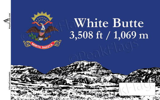
The Badlands lie in southwestern North Dakota. The Badlands are exposed surfaces of stone and clay that erosion has shaped into striking formations; many shades of browns, reds, grays, and yellows appear in buttes, pyramids, domes, and cones. They stretch for about 190 miles (305 km) and are from 6 to 20 miles (10 to 30 km) wide. In some areas of the Badlands the rocks contain lignite coal that has been burning for many years. The clay above these coal beds has turned bright pink and red. White Butte, the highest point in North Dakota, is located in the Badlands, and stands 3508 ft (1069 m) above sea level.
The Badlands lie in southwestern North Dakota. The Badlands are exposed surfaces of stone and clay that erosion has shaped into striking formations; many shades of browns, reds, grays, and yellows appear in buttes, pyramids, domes, and cones. They stretch for about 190 miles (305 km) and are from 6 to 20 miles (10 to 30 km) wide. In some areas of the Badlands the rocks contain lignite coal that has been burning for many years. The clay above these coal beds has turned bright pink and red. White Butte, the highest point in North Dakota, is located in the Badlands, and stands 3508 ft (1069 m) above sea level.