Been there, conquered that.
The mountainous islands of the Japanese archipelago form a crescent off the eastern coast of Asia. They are separated from the continent by the Sea of Japan. Japan has 108 active volcanoes (10% of the world's active volcanoes) because of active plate tectonics in the Ring of Fire.
The volcanic shoreline of the Asian continent was pushed out into a series of volcanic island arcs. This created the "back-arc basins" known as the Sea of Japan and Sea of Okhotsk with the formal shaping of the Japanese archipelago. The archipelago also has summits of mountain ridges that were uplifted near the outer edge of the continental shelf. About 73 percent of Japan's area is mountainous and scattered plains and intermontane basins (in which the population is concentrated) cover only about 27 percent. A long chain of mountains runs down the middle of the archipelago, dividing it into two halves, the "face", fronting on the Pacific Ocean, and the "back", toward the Sea of Japan. On the Pacific side are steep mountains 1,500 to 3,000 meters high, with deep valleys and gorges.
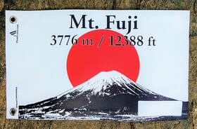
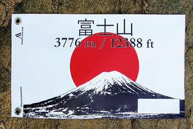
Central Japan is marked by the convergence of the three mountain chains—the Hida, Kiso, and Akaishi mountains—that form the Japanese Alps (Nihon Arupusu), several of whose peaks are higher than 3,000 m (9,800 ft.). The highest point in the Japanese Alps is Mount Kita at 3,193 m (10,476 ft.). The highest point in the country is Mount Fuji (Fujisan, also erroneously called Fujiyama), a volcano dormant since 1707 that rises to 3,776 m (12,388 ft.) above sea level in Shizuoka Prefecture. On the Sea of Japan side are plateaus and low mountain districts, with altitudes of 500 to 1,500 meters. Learn more.
The volcanic shoreline of the Asian continent was pushed out into a series of volcanic island arcs. This created the "back-arc basins" known as the Sea of Japan and Sea of Okhotsk with the formal shaping of the Japanese archipelago. The archipelago also has summits of mountain ridges that were uplifted near the outer edge of the continental shelf. About 73 percent of Japan's area is mountainous and scattered plains and intermontane basins (in which the population is concentrated) cover only about 27 percent. A long chain of mountains runs down the middle of the archipelago, dividing it into two halves, the "face", fronting on the Pacific Ocean, and the "back", toward the Sea of Japan. On the Pacific side are steep mountains 1,500 to 3,000 meters high, with deep valleys and gorges.
Central Japan is marked by the convergence of the three mountain chains—the Hida, Kiso, and Akaishi mountains—that form the Japanese Alps (Nihon Arupusu), several of whose peaks are higher than 3,000 m (9,800 ft.). The highest point in the Japanese Alps is Mount Kita at 3,193 m (10,476 ft.). The highest point in the country is Mount Fuji (Fujisan, also erroneously called Fujiyama), a volcano dormant since 1707 that rises to 3,776 m (12,388 ft.) above sea level in Shizuoka Prefecture. On the Sea of Japan side are plateaus and low mountain districts, with altitudes of 500 to 1,500 meters. Learn more.