Nevada is officially known as the "Silver State" because of the importance of silver to its history and economy. It is also known as the "Battle Born State" because it achieved statehood during the Civil War (the words "Battle Born" also appear on the state flag); as the "Sagebrush State", for the native plant of the same name; and as the "Sage-hen State". The name means "snow-covered" in Spanish, referring to Nevada's small overlap with the Sierra Nevada mountain range; however, the rest of Nevada is largely desert and semi-arid, much of it within the Great Basin.
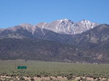
Nevada is almost entirely within the Basin and Range Province and is broken up by many north–south mountain ranges. Most of these ranges have endorheic valleys between them, which belies the image portrayed by the term Great Basin.
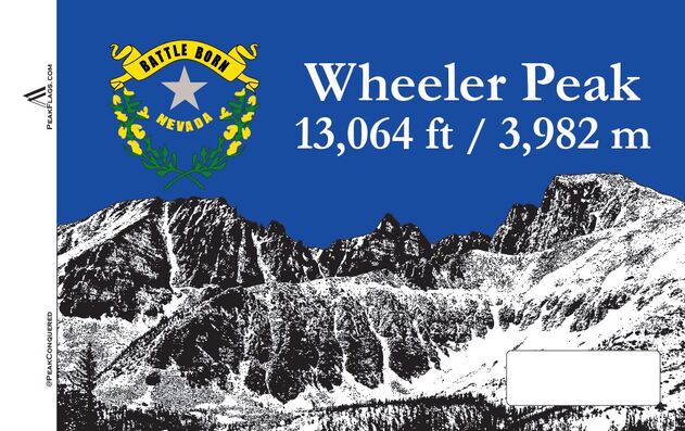
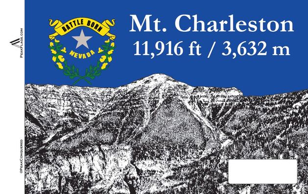
The mountain ranges, some of which have peaks above 13,000 ft (4,000 m), harbor lush forests high above desert plains, creating sky islands for endemic species. The valleys are often no lower in elevation than 3,000 ft (910 m), while some in central Nevada are above 6,000 ft. (1,800 m).
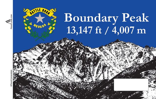
Boundary Peak is the northernmost peak of 13,000 ft or greater elevation within the White Mountains. With a peak elevation of 13,147 ft (4,007 m), it is the highest natural point in the state of Nevada. The summit is in Esmeralda County of southwestern Nevada and is within the Boundary Peak Wilderness of the Inyo National Forest. It is less than half a mile (1 km) from the California state line, which is how it derived its name. While it is the highest point in Nevada, the considerably taller Montgomery Peak (13,441 ft (4,097 m)) is less than a mile away, across the state line in California.
Nevada is almost entirely within the Basin and Range Province and is broken up by many north–south mountain ranges. Most of these ranges have endorheic valleys between them, which belies the image portrayed by the term Great Basin.
The mountain ranges, some of which have peaks above 13,000 ft (4,000 m), harbor lush forests high above desert plains, creating sky islands for endemic species. The valleys are often no lower in elevation than 3,000 ft (910 m), while some in central Nevada are above 6,000 ft. (1,800 m).
Boundary Peak is the northernmost peak of 13,000 ft or greater elevation within the White Mountains. With a peak elevation of 13,147 ft (4,007 m), it is the highest natural point in the state of Nevada. The summit is in Esmeralda County of southwestern Nevada and is within the Boundary Peak Wilderness of the Inyo National Forest. It is less than half a mile (1 km) from the California state line, which is how it derived its name. While it is the highest point in Nevada, the considerably taller Montgomery Peak (13,441 ft (4,097 m)) is less than a mile away, across the state line in California.